Archaeology Phase 3
As part of the PTC (Pennsylvania Turnpike Commission) Northeast Extension MP A38-A44 project AECOM archaeologists conducted two data recovery excavations, which spanned the spring and summer of 2019. Data recovery excavation is the process of carefully deconstructing, or taking apart, the site and carrying it away for study, ensuring that all of the significant information from a site is recovered and removed before construction begins. Such excavations are only undertaken if construction activities cannot avoid the site. During data recovery excavations, archaeologists collect artifacts, the objects left behind by past peoples, that can tell us about their lives. Archaeologists also look for features. Features are disturbances in the ground that are evidence of people using that area, but which cannot be collected or moved. Examples of features include things like foundations, pits, and hearths (outdoor fireplaces or areas of burning). Archaeologists measure, draw, and take pictures of features when they find them, to create a record of what they were and where they were located.
Archaeologists pay special attention to where artifacts and features are found and how they relate to one another in three dimensions (length, width, and depth). This allows archaeologists to effectively recreate the site, or at least the physical relationship of its parts, at a later time to study it further. Part of this process means that archaeologists record information about the layer of soil where they find artifacts. For archaeologists, knowing where something came from in the ground is called its context. Soils are layered, like a birthday cake, with the older soil being deeper than the newer soils. As archaeologists dig down, they are effectively digging back in time. Knowing at what depth and in what soil artifacts were found, helps archaeologists relate an artifact to a particular period in time. It lets them know when people used a site, as well as, potentially, what the environment was like at that time.
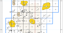
Maintaining a record of the context of features and artifacts was key to helping archaeologists understand what occurred at the two sites excavated as part of the PTC Northeast Extension MP A38-A44 project. Archaeologists established a grid of 1 x 1 meter squares (3.28 x 3.28 feet), like a checkerboard, across the site. They used this grid to keep track of where artifacts came from on the site. Each 1 x 1meter square in the grid, called a test unit, was further broken up into four smaller 25 x 25 cm squares to help maintain a more detailed record of where in the ground artifacts were recovered. Areas of the site with undisturbed soils, or where there were features, were sifted through 1/8-inch screens to capture as many artifacts as possible. More disturbed areas were sifted through larger 1/4-inch screens. Recovered artifacts were taken to the AECOM archaeological laboratory in Burlington, New Jersey, for cataloging and analysis. Archaeologists used the information they collected on artifacts and where they came from to create detailed maps showing where artifacts of particular types were concentrated across the site. This helped them determine how areas within the site were used by the people who once lived there.
During excavation, archaeologists collected samples of the soils from features and around concentrations of artifacts. These soil samples were taken to the lab and the soil was passed through a series of increasingly smaller mesh screens inside a tank of water, a process called flotation. Flotation helped archaeologists recover small artifacts like seeds, shells, nutshell, chipped stone debris from stone tool making, and charcoal. Recovering nutshells, shells, and seeds helped archaeologists to identify what plants and animals were available in the local area when people lived at the site and it helped to identify some of the foods that were part of their diet. In some cases, burnt organic material (things that were once alive) were found in the floatation samples. Burnt material like charcoal and nutshells are important because they can be radiocarbon (Carbon-14 dating) dated. Dating these materials helped provide a date for all of the artifacts in the same layer of soil. This dating information helped archaeologists understand when many of the features they encountered were created and used.
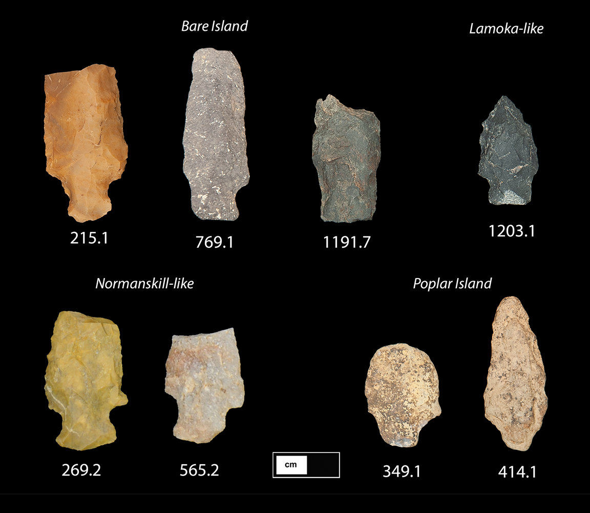
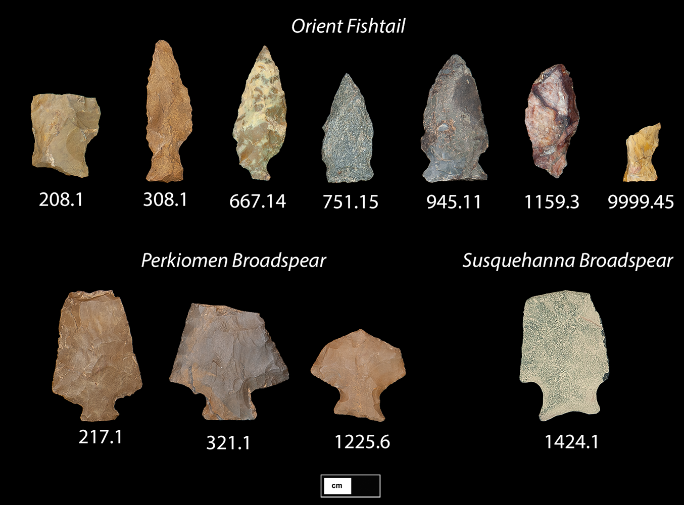
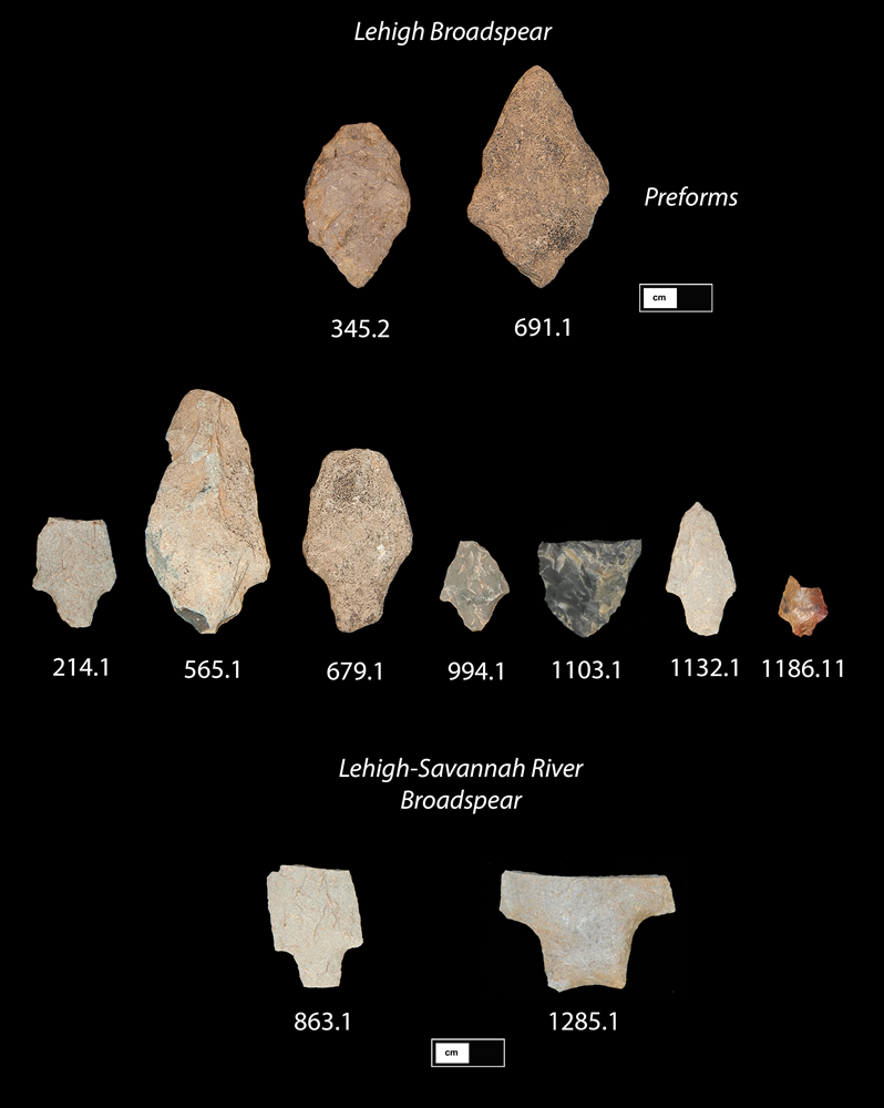
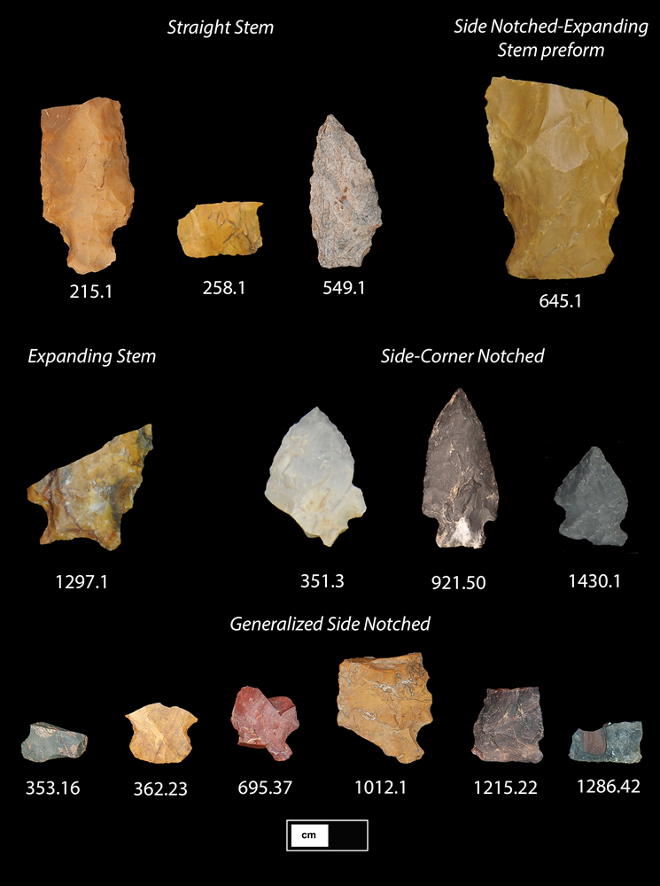
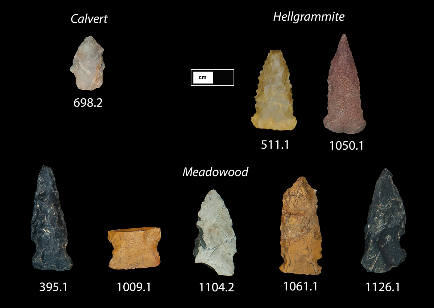
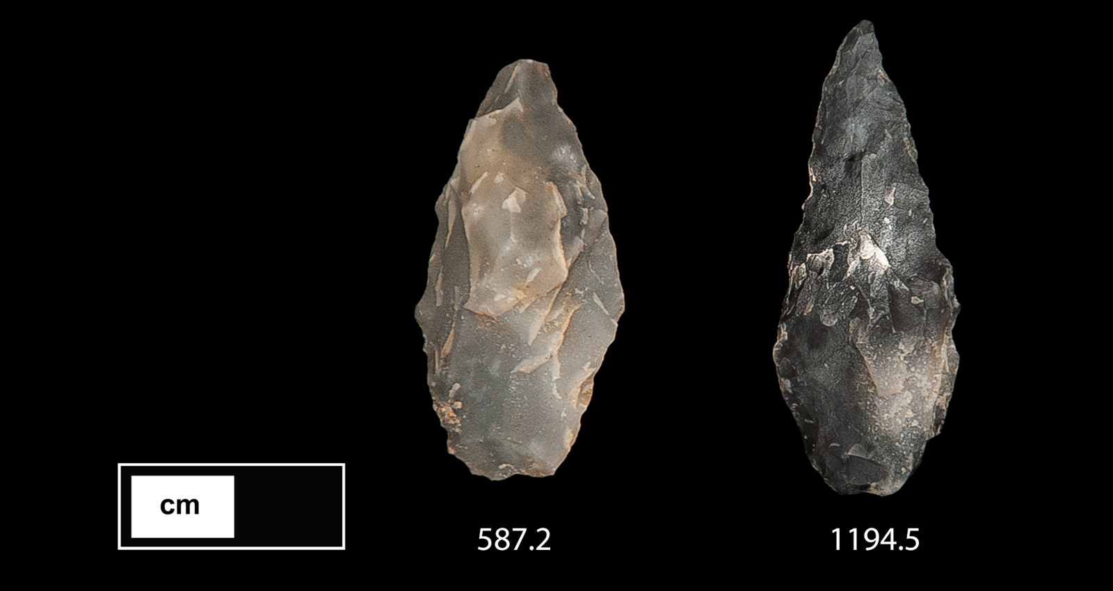
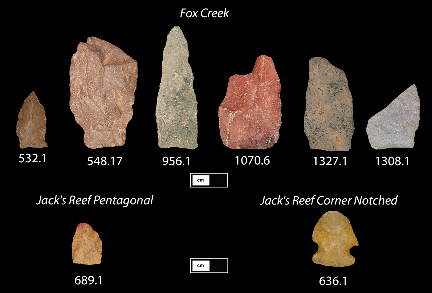
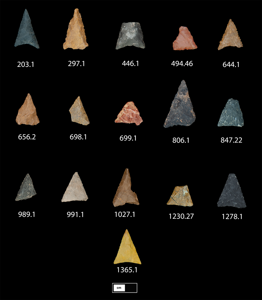
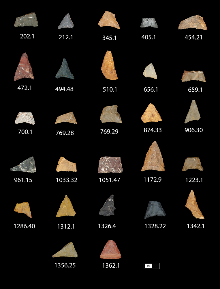
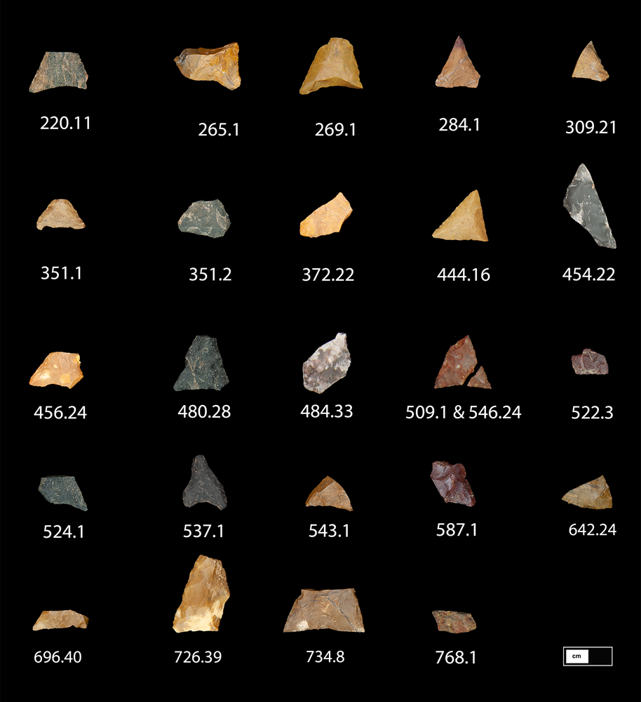
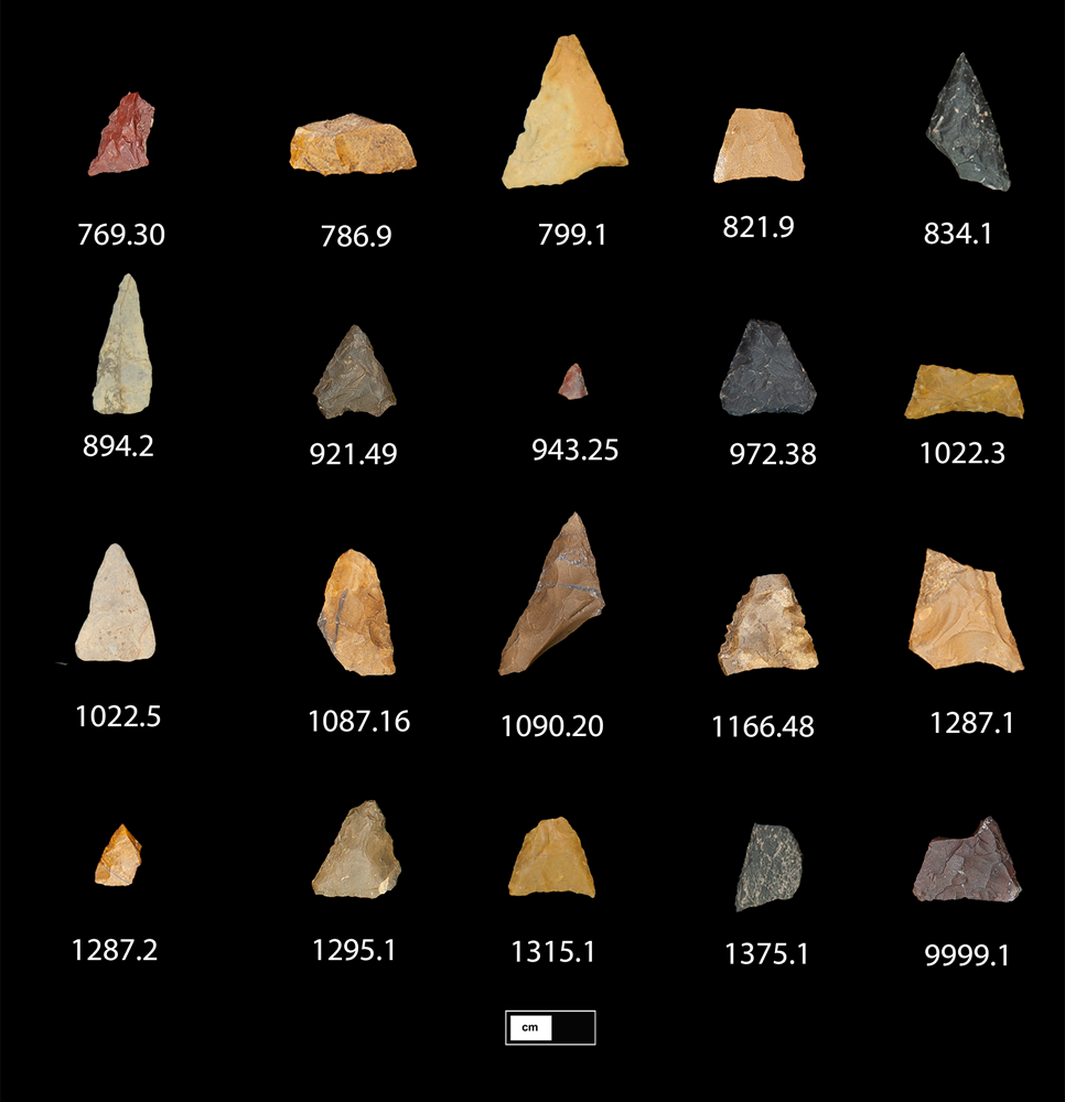
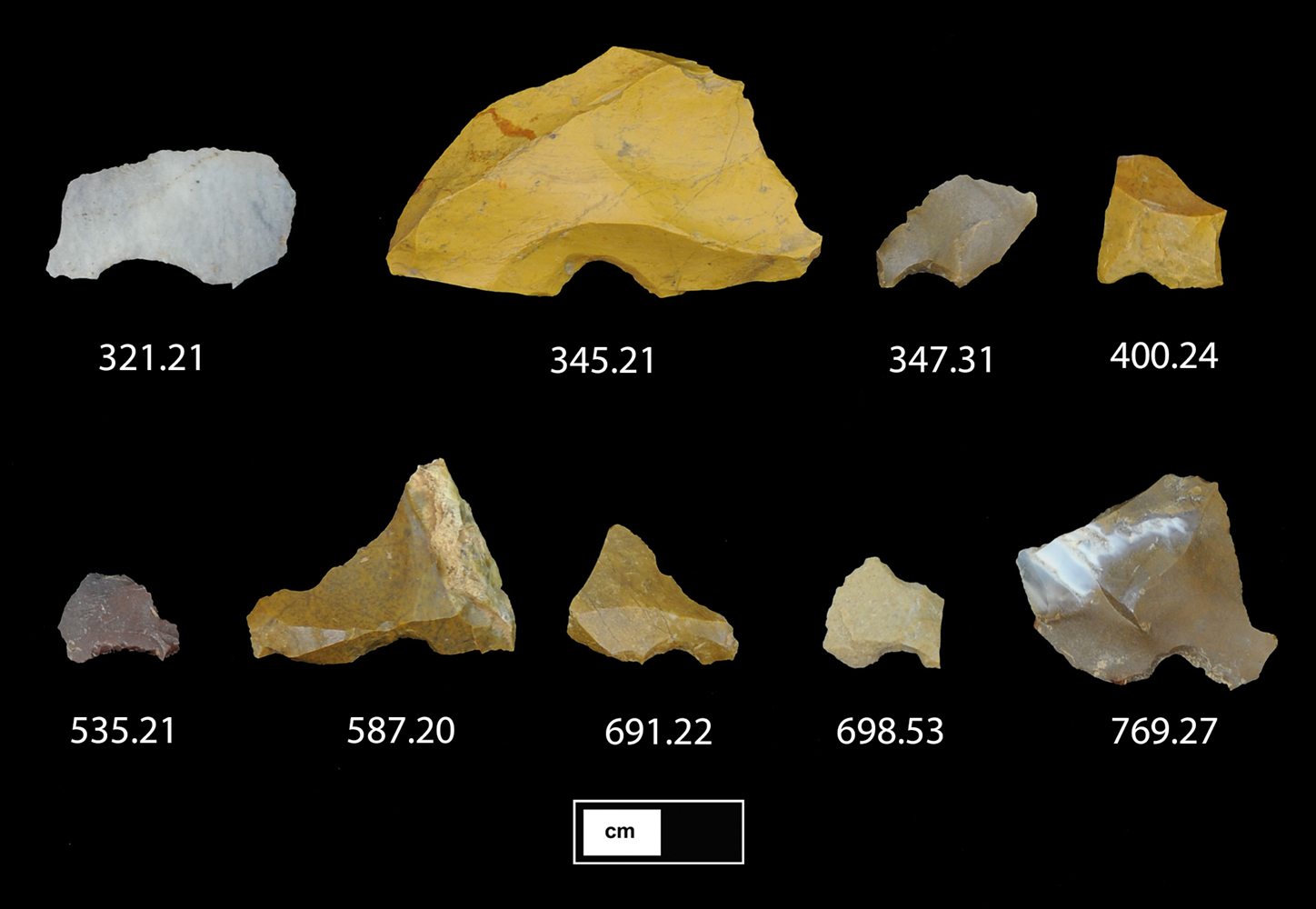
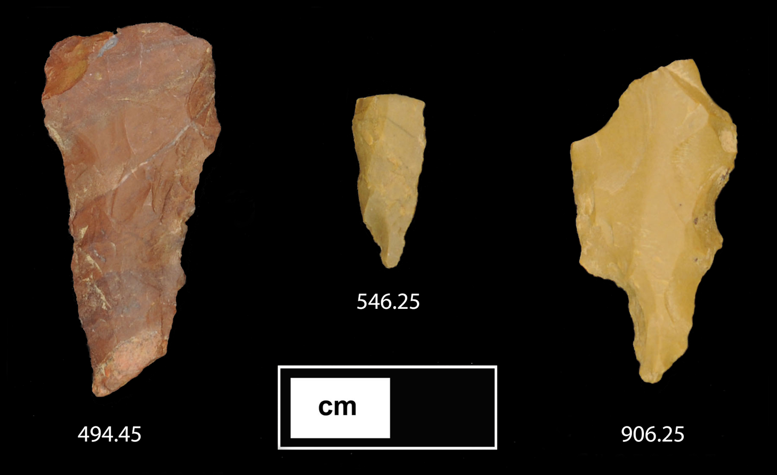
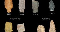
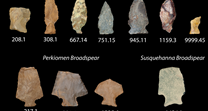
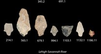
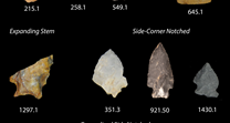
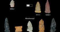
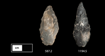
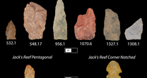
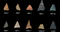
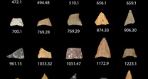
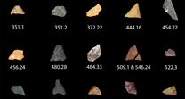
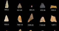
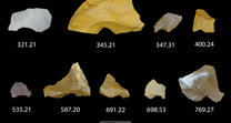
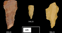
Stone tools are produced by chipping flakes of stone to produce a particular shape in a process called flint knapping. This process involves striking a rock (usually made of a glass-like stone) with a hammer (made of bone, stone, or wood) to remove flakes of the stone in a predictable way. By repeatedly removing flakes of stone from a stone core, native peoples were able to produce a variety of stone tools, like arrowheads and spearheads, knives, scrapers, drills, and awls, which they used to help them with daily tasks. Archaeologists can study these tools and the debris to find out what they were doing at a site. A careful study of the stone tools and tool-making debris found on these sites provided clues about the types of stone that native populations usually used, possible stone trade networks, hunting and gathering practices, and the stone tool technology they used.
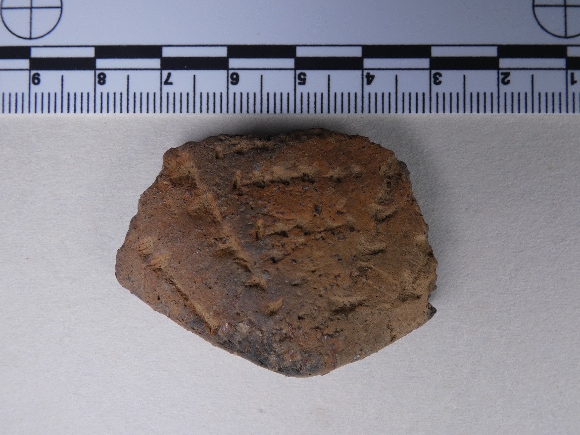
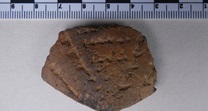
Examining and classifying the pottery, by decoration and shape, helped provide evidence of the cultural affiliation of the Native American peoples who lived at the site. Styles of pottery changed over time in the same way that cars, computers, or cellphones change models and styles today. These modern objects largely do the same thing as other models, but they look different, depending on how old they are and who made them. The same process applies to pottery in the past as well as stone tools. Styles and shapes changed over time depending on who made them. Identifying these attributes in the ceramic collection helped to determine who was living on the sites and when. In some cases, food residues on fragmentary pieces of ceramic called sherds, told archaeologists what people were cooking and eating on site.

Photo 7: Soil samples from the Unami Creek Open Site being run through the flotation tank to capture small artifacts like seeds, nutshell, charcoal, fish scales, small bones, small chips of stone from tool production
Unami Creek Open Site (36BU0445)

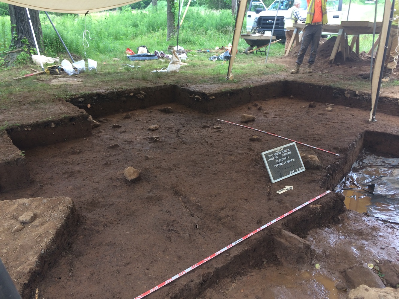
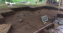
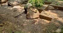
Photo 8: Excavation of Test Units and screening for artifacts at Unami Creek Open Site
Archaeologists excavated 126 1x1m test units and four backhoe trenches at the Unami Creek Open Site. During the excavation, archaeologists identified 39 features and collected 87,012 Native American artifacts. Flotation of feature soils recovered an additional 41,203 organic artifacts like seeds, nutshell, and charcoal.
Examination of the artifacts recovered from the site showed that it had been periodically occupied from the Early to Middle Archaic period (approx. 10,100 Before Present (BP)) to the end of the Late Woodland period and the beginning of the Contact Period (approx. 400 BP). The dates the site was occupied were established using a combination of radiocarbon dates and the known manufacturing dates associated with specific styles of spear/arrow points and pottery. While people occupied the site during the Archaic period, the size of the groups was small, and they only stayed a short while. Thousands of years later, during the Woodland period, however, the site was frequently revisited by groups of one or two families who stayed for longer periods. Most of the evidence suggests that larger and longer occupations on site occurred during the Late Woodland period (1050 to 400 BP).
The stone tool artifacts recovered from the site suggest that Native Americans living on the site made the bulk of their tools from a glass-like rock called jasper, which they collected from stone quarries in the Hardyston Formation located to the north of the site (near modern-day Vera Cruz, Pennsylvania). Using jasper, Native Americans produced arrow and spear points, scrapers, spokeshaves (tools used to straighten and smooth wood), drills, knives, and various quickly produced cutting and scraping tools. They used these tools to process plant and animal materials for food and clothing.
Native groups seem to have principally occupied the site in the late Summer and Fall. In this region, native groups typically moved several times a year to take advantage of season-specific environmental resources available in different parts of their territory. They frequently moved following the resources instead of staying put year-round. Typically, local groups spent their spring and summer in larger social groups along the Delaware River, where they worked together to harvest fish from the river and spent the cooler months in smaller groups further inland, focusing on hunting and collections of nuts and berries. Microscopic traces of blood left on arrow and spear points suggested that native peoples, occupying the Unami Creek Open Site, hunted large ground rodents like groundhogs and beaver, which helped supplement larger game, like deer. Examination of seeds and pollen/starch analysis suggests that cool-season grasses, walnuts, hickory nuts, hazelnuts, raspberries, huckleberries, blackberries, and wild grapes were common parts of their diet as well.
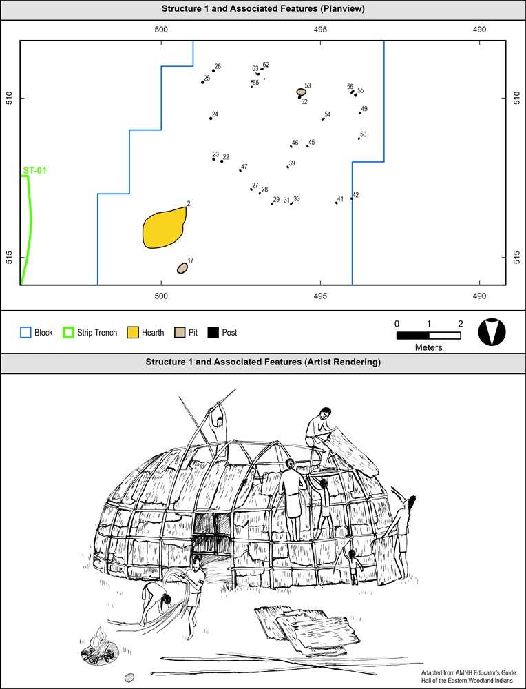
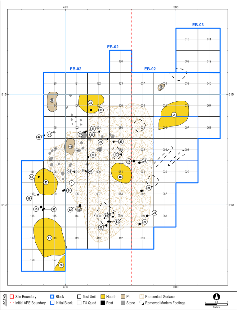
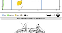
In the southern portion of the site, AECOM archaeologists uncovered a pattern of posts that formed an oval-shaped house pattern. This house pattern was approximately 5.75 x 4.5 m (18.9 x 4.75 ft) in dimension and corresponded with a dark stain of soil. Archaeologists determined that the house pattern was likely that of a wigwam. A wigwam is a type of Native American dwelling typically made by constructing a dome-shaped frame out of bent sapling trees, lashed together, and then covered by a skin of tree bark, animal hides, or woven grass mats. This house was not by itself, as radiocarbon dating showed that there was an outdoor hearth to the northeast that dated to the same period as the wigwam.
By examining where concentrations of artifacts occurred on-site, archaeologists identified other areas of the site that were dedicated to specific tasks like hide-processing (the process of cleaning and preparing animal skin for use as clothing or covering), making stone tools, and woodworking. In areas where hide-processing occurred, features called smudge pits were identified. Smudge pits are small pits designed to produce smoky, smoldering fires, the smoke from which was used for tanning hides to make wearable leather or buckskin. Near these features, tools like scrapers, that were used to clean and prepare the hides for smoking, were frequently found. Concentrations of tools like spokeshaves (tools used to straighten and smooth wood), knives, and other cutting tools indicated areas dedicated to woodworking. Areas of stone tool production were identified, based on the presence of a lot of chipped stone debris and cobbles that had been used as hammers.
Archaeologists also recovered a single kernel of maize (early corn), which was radiocarbon dated to the same part of the Late Woodland as the wigwam. The presence of this maize kernel suggests that during this Late Woodland occupation, the Native Americans who lived there were part of a society that did some farming or had trade relationships with groups that did farm. No evidence of farming on the site was encountered, however, so the maize was likely grown elsewhere and brought to the site. The presence of maize on site is important because domesticated plants like maize were not native to the region and their use suggests a shift in the way people got food. The introduction of farming as a means of producing food shows a transition away from a lifestyle where people frequently moved, surviving off of the land by hunting and gathering, to a more settled lifestyle where people grew what they needed where they were, instead of moving to find it.
The Late Woodland period wigwam house pattern sat atop several earlier hearths from the earlier Middle Woodland period, indicating that this later dwelling had been built in an area of the site that had been used repeatedly by previous groups. While structural remains of a wigwam survived for only one of the later occupations on site, the concentrations of artifacts and dated features in the same area suggest that this southern part of the site, overlooking the floodplain where Butter Creek joins the Unami Creek, was the center of many occupations from the Terminal Archaic through the Late Woodland periods. The repeated use of the site is likely due to its situation at a junction between creek drainages. Before the construction of roads and highways, streams and rivers were travel corridors that people used to navigate through the landscape. From the site of the Unami Creek Open Site at the junction of the Butter Creek and Unami Creek, a person could travel south to the Perkiomen Creek and the Schuylkill River, go upstream toward the Jasper quarries of the Hardyston Formation, or follow Butter Creek east to the Tohickon Creek drainage, which leads to the Upper Delaware River. Essentially, the site was located at a prehistoric crossroads, which might help explain its frequent reoccupation over the millennia.
Split Site East (36BU0449)
Archaeologists excavated 327 test units at Split Site East and found seven Native American features. These features included including a post hole, two hearths, and four pits. Archaeologists recovered 11,748 Native American artifacts and 1,510 organic artifacts like charcoal, seeds, and nut fragments during excavation.
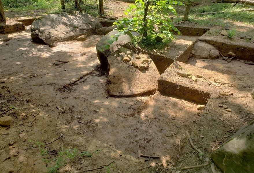
The way archaeologists excavated Split Site East was a bit different from the techniques used at Unami Creek Open Site, as all excavation at Split Site East was done by hand. The location of Split Site East is heavily wooded, preventing the use of a backhoe, and unlike the Unami Creek Open Site, which was in a plowed farm field, the large boulders across the site had prevented the area from being farmed, meaning that the soils had not been disturbed by plowing. The test unit, feature, and excavation recording procedures used by the archaeologists, however, were largely the same as on the Unami Creek Open Site.
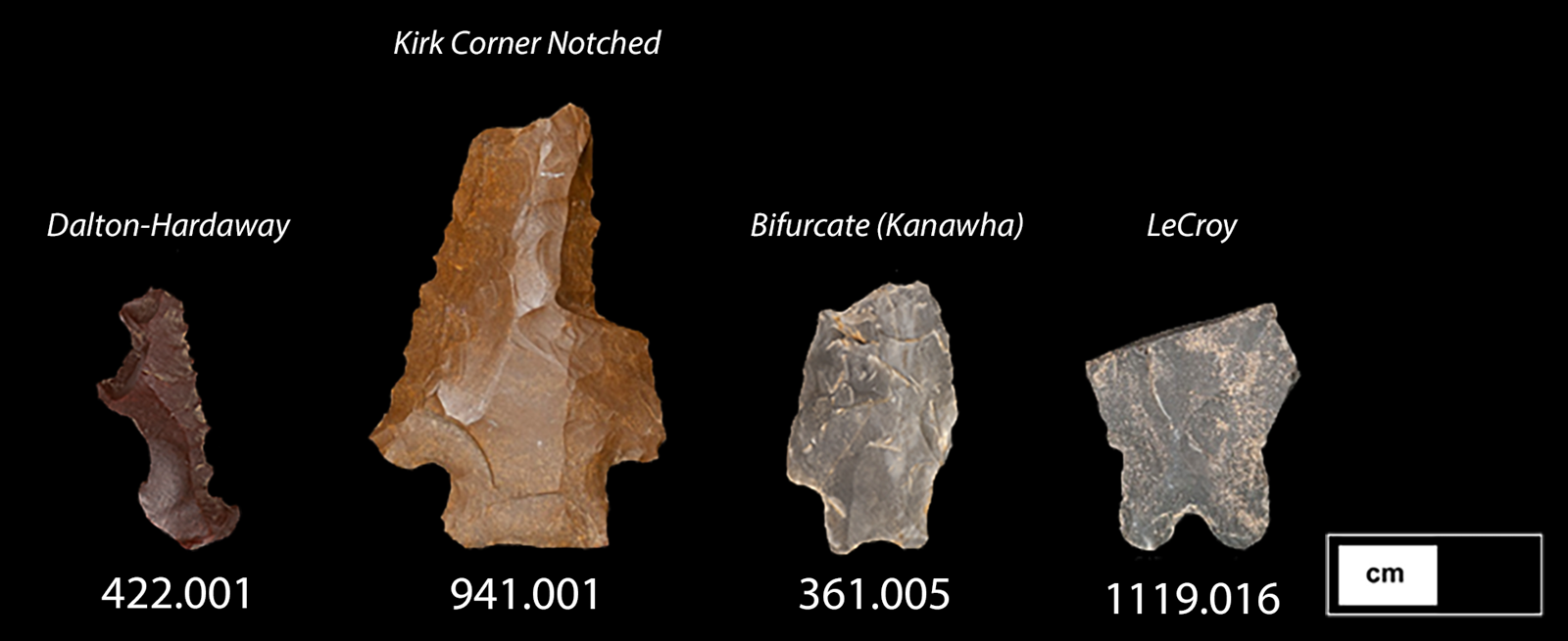
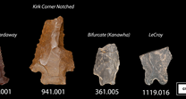
Datable artifacts from the excavations at Split Site East suggest that the site had been used as a hunting ground periodically from the Late Paleoindian period to the Late Woodland period, with larger campsite occupations occurring during the Terminal Archaic/Early Woodland to Middle Woodland (4,300-1,020 BP). Evidence of hunting came from small discrete clusters of impact-damaged (break caused by hitting something solid like bone) spear or arrow points, found with small amounts of chipped stone tool debris, disposable tools, cutting tools, and scrapers that were not associated with features. Archaeologists interpreted these clusters of artifacts as evidence of episodes of hunting and related butchering and tool repair. The stylistic types of arrow and spear points found with these small clusters of artifacts varied widely in date across the site. This suggested a similar use of the area for a long period of time. Examination of blood residue on arrow and spear points from the site, suggested that Native American hunters exploited game like turkeys, wolves/dogs, and fish.
In the Terminal Archaic and Early Woodland periods, the nature of the occupation changed to include, not just short-term hunting use, but also longer-term campsites where stone tool production, hafting (adding shafts or handles to stone tools), animal hide preparation, and cooking activities likely took place. These more substantial occupations were located among a collection of boulders in the middle of the site. There, archaeologists found a number of hearth and pit features. In the western part of the boulder group, archaeologists found several Orient Fishtail-type spear points around a hearth feature. The Orient Fishtail style of spear point was commonly produced between 3,200-2,600 BP, spanning the Terminal Archaic to Early Woodland periods. The date range for this style of spearpoints was in keeping with the radiocarbon dates of the hearth feature in the middle of the spearpoint cluster, suggesting a campsite occupation during the beginning of the Early Woodland, specifically the period 2,800-2,400 BP. Nearby, several later Middle Woodland period pits and hearth features were also found amongst the cluster of boulders to the east. These Middle Woodland features were characterized by the presence of Fox Creek and Jack's Reef-type spearpoints and dated to between 1,600 BP and 1,020 BP.
In a flat and open area in the northwestern part of the site, archaeologists discovered a dense concentration of disposable jasper stone tools, jasper chipped stone tool debris, spokeshaves, and several scrapers. The stylistic types of arrow and spear points found in association with this artifact concentration suggested that this area of the site was used during the Terminal Archaic/Early Woodland period. While the number of artifacts found in this area was high, no features like pits or hearths were found in this area. Archaeologists considered this area to be a workshop, where people produced and repaired stone tools, or perhaps where they butchered animals and processed hides.
While bordered to the south by wetlands today, before the construction of the Pennsylvania Turnpike Northeast Extension, the area south of the site was the dry lower slope of a south-facing hill overlooking the Ridge Valley Creek. This is important because, before the construction of roads and highways, streams and rivers were travel corridors that people used to navigate through the landscape. From this site, you could travel west through a break in the ridgeline and access the Unami Creek. From there, you could travel north to the jasper quarries of the Hardyston Formation or follow it south to the Perkiomen Creek and the Schuylkill River. Following the Ridge Valley Creek downstream also led to the Perkiomen Creek, and following it upstream led east to the headwaters of Three Mile Run, which joins up with the Tohickon Creek, and ultimately the Upper Delaware River. Like the Unami Creek Open Site to the north, Split Site East's location in the landscape lay at a natural crossroads for people and animals traveling along these creeks and streams, making it an attractive spot for repeated occupation over the millennia.